Seasonal weather Friday before overnight rain showers
SAGINAW, Mich. (WNEM) - Our next round of showers will be much lighter than Wednesday and comes in at a more convenient time: during the overnight. This means for this Friday, the forecast remains pleasant during the day! Even most of the weekend is in nice shape too. For Loons Baseball opening up today, rain should also hold off just long enough for the game. Details below!
A Flood Warning remains in effect on both the Rifle and Cass Rivers after the heavy rains from this week. More warning information is available in our Weather Alerts section.
Today
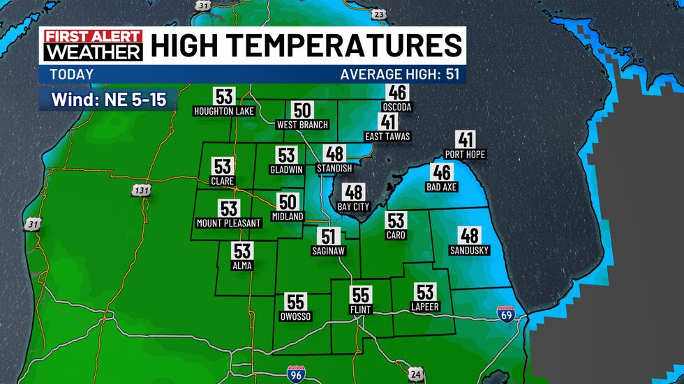
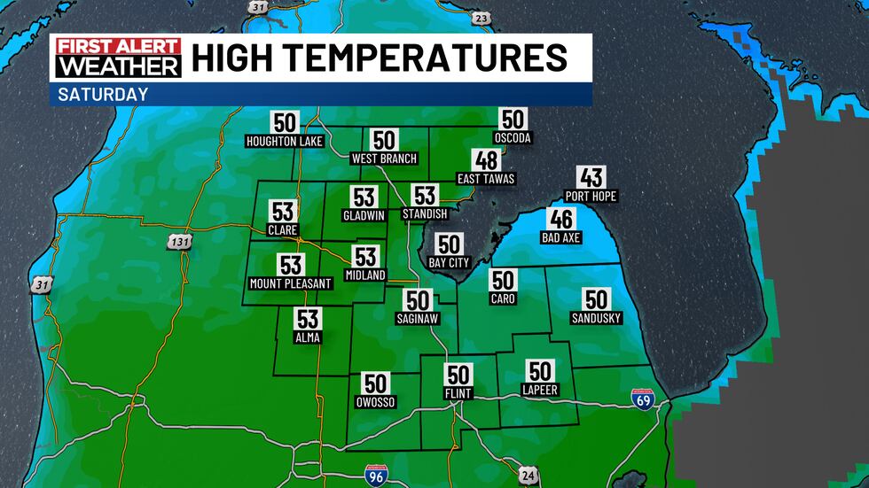
We’ll be able to start the day with sunshine though before cloud coverage increases in the afternoon due to the upcoming rain showers. Highs will range anywhere from the 40s to the 50s today, all depending upon your proximity to Lake Huron. Notice in the map below, due to a northeast wind, temperatures will remain cooler closer to the shoreline, but be relatively mild anywhere away from the water. The normal high for April 4th is 51 degrees. That northeast wind will have a speed of 5 to 15 mph.
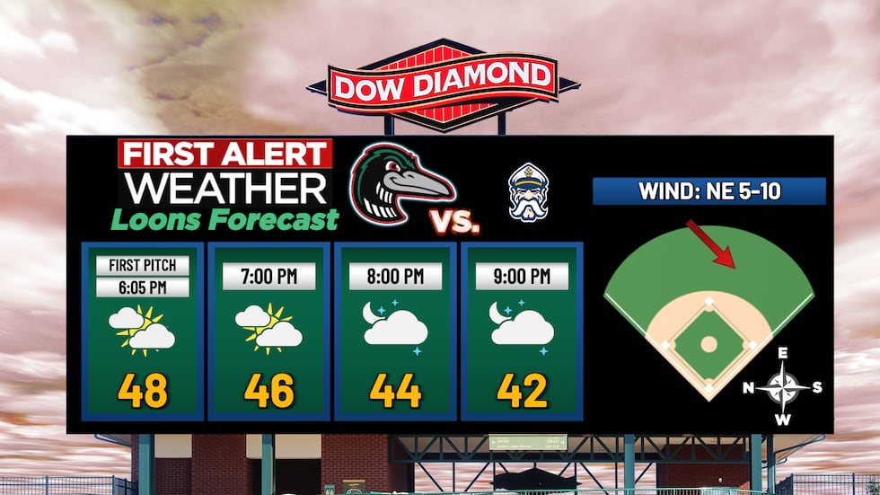
Temperatures will start falling through the 40s this evening at Dow Diamond. While it will be cooling down, these numbers are right about where they should be for the start of baseball season. At the ballpark, just expect a northeast wind coming out of left field at 5 to 10 mph. Have fun and GO LOONS!
Tonight
Rain showers are expected to hold off long enough to be able to get through the game with dry weather. Showers will likely start near midnight, but will be quite isolated at that time.
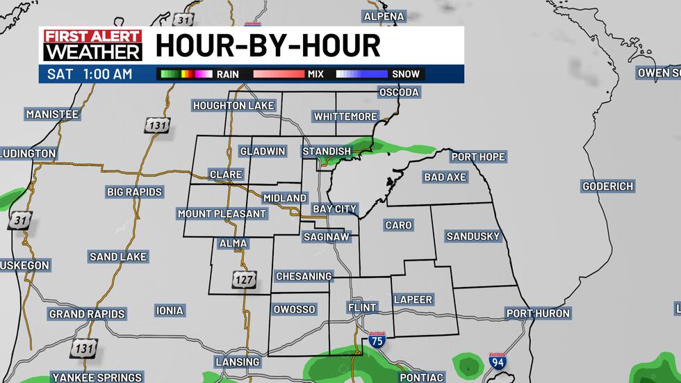
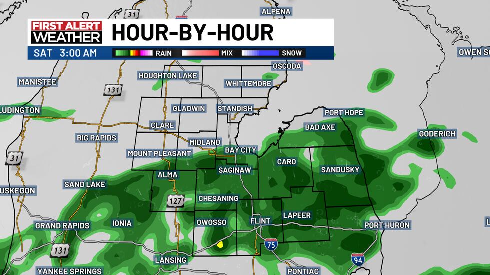
Through the overnight, rain will start to turn more scattered and be able to reach nearly all of mid-Michigan at one point or another. Rain through the overnight just falls at a light rate, so we don’t have the excessive rainfall or flooding concerns with this rain, unlike Wednesday.
Lows will fall to 37 degrees with a northeast wind at 5 to 10 mph.
Weekend Forecast
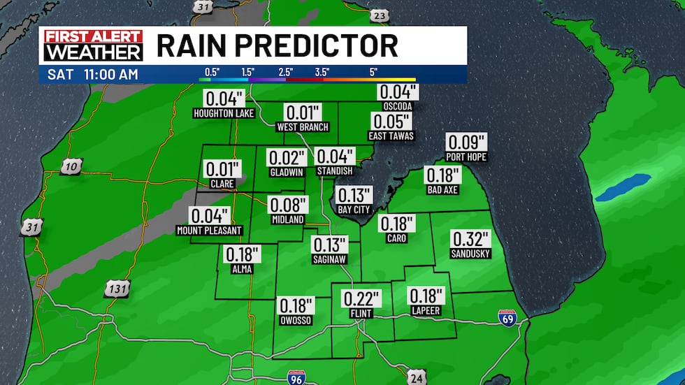
Those showers will also be around in the morning as you’re getting breakfast going. However, we expect rain to leave around 10 AM and from there, the rest of the day is dry!

Totals from this rain will range up to 0.5″, increasing the farther south you go through our area.
We’re expecting more of a mostly cloudy sky for the rest of Saturday afternoon and evening, though there will be the occasional peek of sunshine. Clouds will then start clearing out going into Saturday night.
Highs on Saturday afternoon will peak around 50 degrees. The wind will also back from the northeast to the northwest and maintain a speed of 5 to 15 mph. Saturday night will see a clearing sky with a low of 29 degrees.
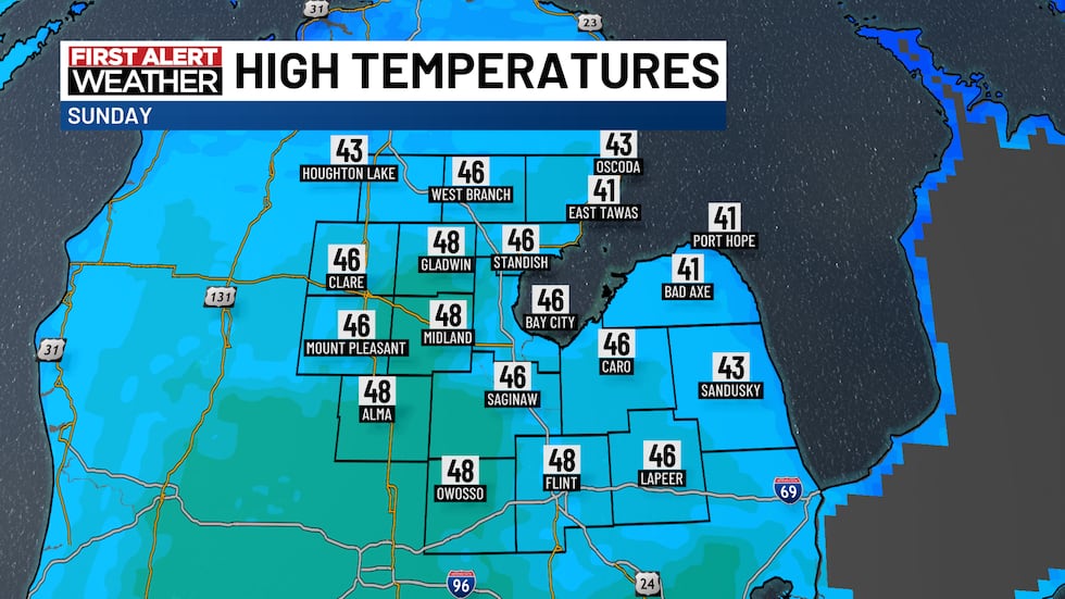
While Sunday is a few degrees cooler at 47 degrees, the day will be dry with partly to mostly sunny skies! Overall, it’ll be a quiet day. Take advantage of these weather conditions though, because Monday has a cold front moving through that’ll cool us back down again to start the week. A peek at that is in the TV5 First Alert 7-Day Forecast!
Copyright 2025 WNEM. All rights reserved.


